Sharing the Trails: People and Wildlife in the Sooke Hills
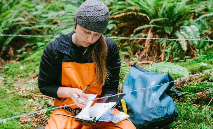
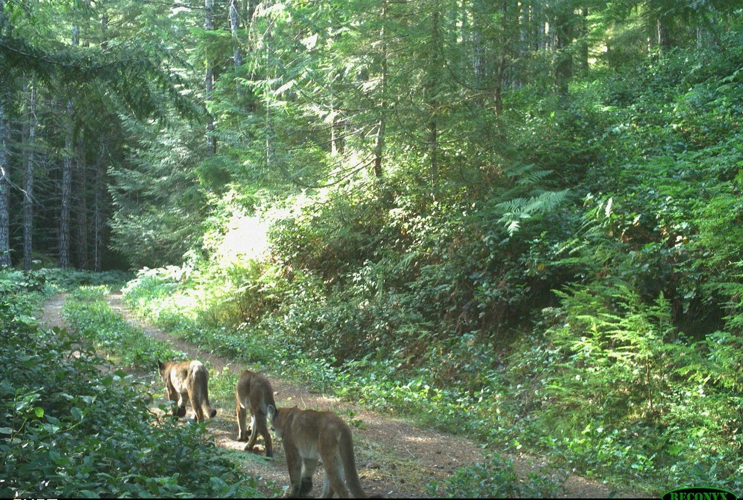
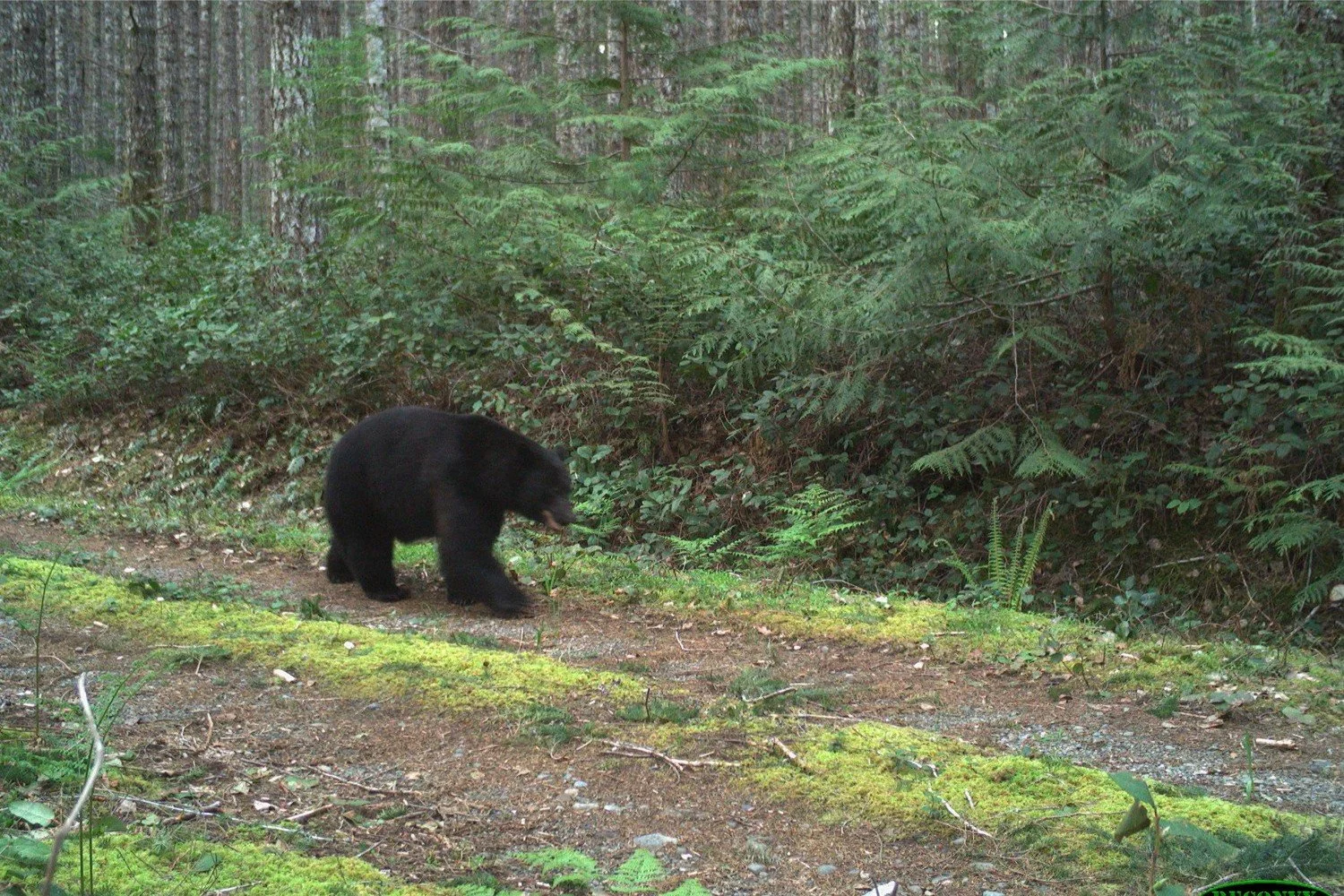
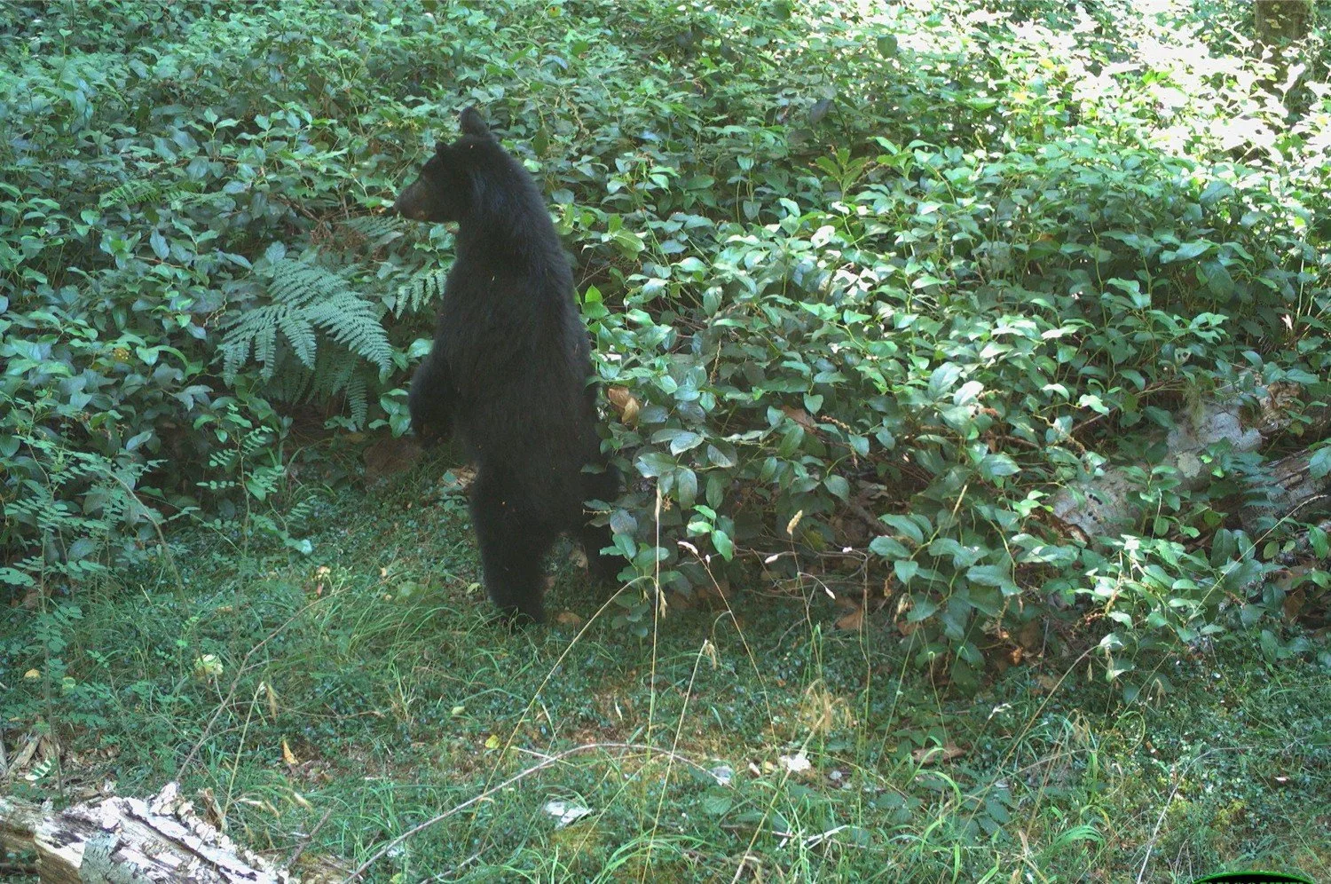
The Sooke Hills Wilderness Project is an exciting program initiated by Coexisting with Carnivores Alliance (CwCA) and led by Dr Chris Bone of the University of Victoria. Trail cameras are used to track the movements of both park users and wildlife like cougars, bears, deer and wolves. CwCA developed the concept of the project, brought UVic and the Capital Regional District (CRD) onboard as partners, provided leadership to implement the project, and are enthusiastic about supporting its growth.
Why is this research important?
Southern Vancouver Island is home to wonderful biodiversity, including vegetation, wildlife and other organisms, and especially large carnivores. Carnivores have large home ranges that require vast tracts of suitable habitat. In the CRD, these habitats are under threat. Natural landscapes are rapidly being converted into urban spaces while industrial activities such as logging continue, and climate change adds pressure to already stressed natural systems. On top of this, recreation in protected spaces affects species even in intact habitat. Dr Bone says this rapid development is occurring without any real understanding of the impacts on wildlife. The Sooke Hills project aims to inform how to preserve wildlife populations in the face of all these major landscape changes.
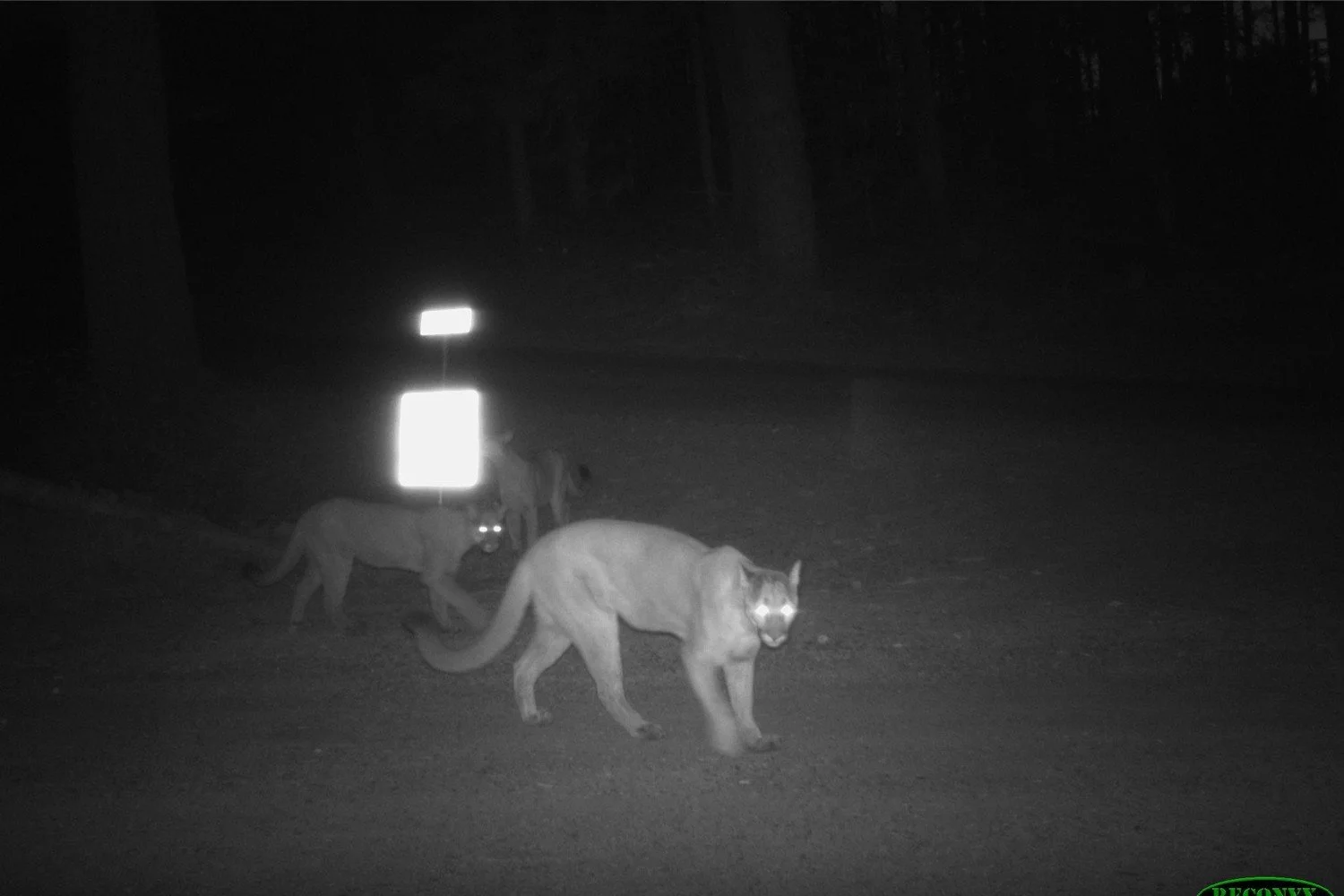
The CRD is an understudied area considering the high biodiversity, including one of the largest cougar populations in North America. There’s a lack of baseline knowledge about wildlife numbers, movements and distributions. A lot of the data on predators comes from conflict, or where animals are spotted coming into towns such as Sooke. This means the majority of what the public sees about these predators is negative media hype. “Very few conflicts do exist, when you look at how many people and how much wildlife there are. But they all get overblown,” says Dr Bone. “People you talk to, it's, oh, there's cougars out there, I hope I don't run into one. Versus, oh, there's cougars out there, okay, well, gosh, there's a lot of development happening, shouldn't we think about this better? We really need to work towards, what are the resources that we can use to educate the public and policy makers to really push them? Because I think right now, there's so little information out there, it's just not on people's radar.”
What has the project found so far?
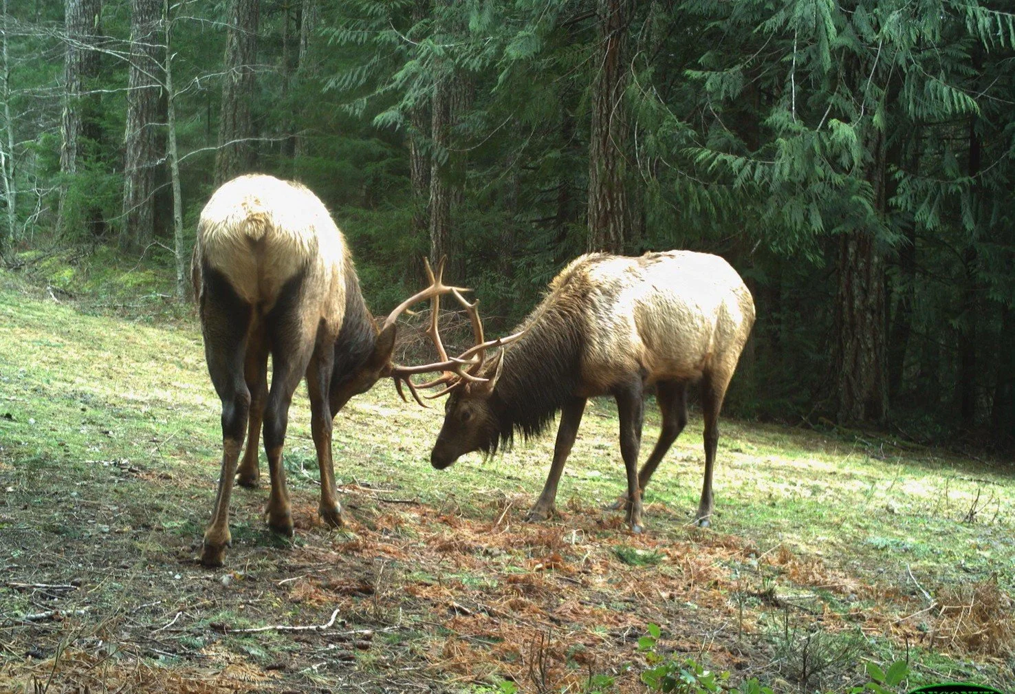
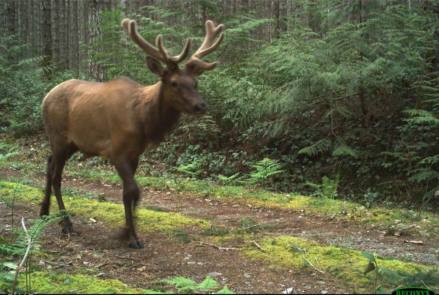
The project involves monitoring 50 camera traps across the Sooke Hills Wilderness Area and Greater Victoria Water Supply Area and has been running since 2021. One of the primary focusses is the impact of recreation on cougars. They’ve found that areas of high recreation impact (i.e. hikers and bikers) are avoided by cougars, and recreation is a more important driver of cougar space use than prey availability or habitat features. However, cougars don’t show avoidance of areas with high vehicle use, and don’t appear to change their daily activity times in recreation areas, suggesting they avoid people by changing the spaces they use rather than the times they use them. Some of this research was published this year, with further papers in the works.
While the main focus is currently cougars, the Sooke Hills project team are also collecting valuable data on other key species such as black bears, wolves and elk, and hope to turn their attention to these species in the future.
What is the future of the project?
A major future focus of the project is improving our understanding of wildlife corridors in the CRD. With additional funding from the province, Dr Bone’s lab is partnering with the Coexisting with Carnivores Alliance, the Habitat Acquisition Trust, and the Coastal Douglas Fir Conservation Group to expand the camera trap network further west to Matheson Lake Park, Roche Cove and East Sooke Park. Data from these cameras will help model corridors and understand how development may threaten these corridors.
Dr Bone’s lab is also working on integrating non-traditional data into corridor and habitat models, such as opportunistic observations from people working on the landscape as well as information from CRD parks, nonprofit wildlife education groups, and First Nations. “I can definitely see this project expanding, not just geographically, but in terms of the types of knowledge that we're trying to bring together,” says Dr Bone. His lab will be hosting an event in January that brings all the interested groups and individuals together – including nonprofits, First Nations, CRD parks, municipalities and planners – for a community mapping session. He aims to solidify an enduring network of parties engaged in these issues. The goal is that this work will lead to concrete outputs such as GIS data layers and maps that are publicly available and easily accessible for planning, advocacy, and other purposes.
The Sooke Hills Wilderness Project shows the value of incorporating wildlife research into planning and development, particularly in an area subject to rapid urbanization. “We really have to start acknowledging the importance of these animals on the landscape,” says Dr Bone. “Any kind of landscape alteration really needs to consider their habitat use and their mobility, or how they're moving through these spaces. Otherwise, we're going to lose them, and I don't think we know what the ramifications of that would be.”
Seminar on trailcamera usage
Dr. Chris Bone of the Surreal Lab based out of University of Victoria, Nitya Chari Harris, a director of the Coexisting with Carnivores Alliance as well as Scott Harris, a citizen scientist with a focus on trailcamera usage led this seminar. The speakers provided the attendees from T’Sou-ke Nation information on trailcamera use in relation to wildlife and land use management, flora and environmental monitoring, anticipated equipment necessary for installation as well as a variety of other technical considerations.
Following the classroom session, the group went into the field for a hands-on demonstration of trailcam installation as well as an insightful Q&A period. The Nation members walked away from this seminar with the knowledge of how to initiate, monitor and maintain a science based trailcamera study
Acknowledgments: This project was enabled due to the generous funding provided by the Jane Goodall Institute of Canada and filmed by Tilai Ellis-Stairs.
WILDLIFE CAMERAS IN SOOKE HILLS PARK: MONITORing the EFFECTS OF HUMAN PRESENCE on wildlife
The Sooke Hills Wilderness Project is a collaboration between the Capital Regional District (CRD), the University of Victoria Surreal Lab and the Coexisting with Carnivores Alliance. Multiple trail cameras are used to track the movement of both park users and wildlife like cougars, bears, deer and wolves. The cameras not only capture animals and people, but also the surrounding forest and plant life, giving researchers the opportunity to see how seasonal and climate changes impact the entire ecosystem over time. According to the CRD, data collected from the project will help inform management decisions in the regional park to better protect important wildlife habitat and support a positive visitor experience.
Farmer/Carnivore Coexistence Project

Over the past 5 years, 54 bears and 30 cougars have been killed in the Capital Regional District (CRD) due to conflict; of these, 14 bears and 22 cougars were killed due to agricultural conflicts. The CwCA is presently working towards:
1. Engaging community members, including farmers and hunters, to assess the degree of carnivore conflict and level of interest in mitigation tools, and to communicate available information on conflict reduction strategies.
2. Implementing mitigation trials based on proven management options to reduce conflict between farmers and large carnivores (cougars, bears and wolves).
3. Examining the effectiveness of these conflict mitigation methods for carnivores and people within the Metchosin study area.
4. Developing a Human Wildlife Conflict Management Plan for Metchosin, and a phased in plan for Southern Vancouver Island, based on the results of this assessment.
Habitat Supply Modelling

The CwCA Carnivore Habitat Working Group is developing regional carnivore habitat supply maps for wolves, cougars, bears and relevant ungulates in the CRD. These maps will be shared with the public and decision makers to inform municipal planning and allow for the consideration of these large carnivores when condcuting an environmental development assessment.